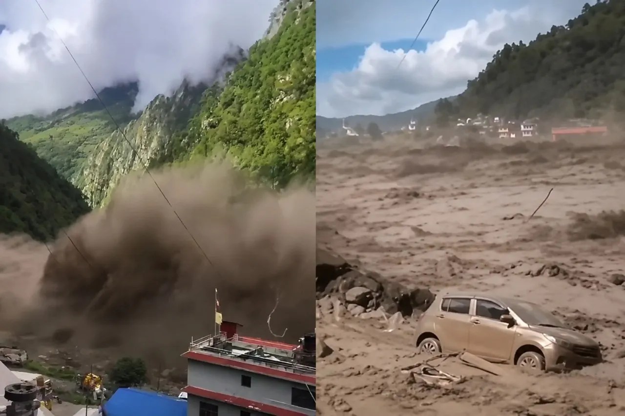
When a wall of water tore down the Bhote Koshi and Lhende river valleys on August 26, 2026, initial reports pointed fingers everywhere. Was it a massive Tibetan earthquake? A sudden glacial lake outburst? Or an ice avalanche that choked the river channels before giving way?
The reality on the ground in Nepal's Rasuwa district and across the border in Tibet was far more destructive than standard weather alerts suggested. Entire mountainsides transformed from green slopes into sterile brown debris fields in a matter of seconds. With hundreds of people missing—including foreign tourists and pilgrims—governments across South Asia scrambled to respond.
Let's look at what actually happened, why the early data confused geologists, and how international rescue efforts rolled out.
Untangling the Trigger: Glacier Collapse Versus Earthquake
Early seismic monitors registered a sharp tremor in Tibetan territory at 8:37 AM local time, recording a magnitude that initially led agencies like the USGS to log a tectonic earthquake. But expert earth scientists quickly realized something did not add up.
Long-period seismic waves told a different story. The ground shaking wasn't caused by shifting tectonic plates deep underground. Instead, it was the catastrophic mechanical energy of a massive glacier snout collapsing from roughly 5,200 meters high, plunging more than a thousand meters down onto the valley floor below.
Think of it as a mountain-sized chunk of ice and rock giving way under thermal stress, creating an immense debris flow that slammed into the river systems. Satellite imagery from Planet Labs captured the stark transformation, showing bare ice where thick snow cover had rested just days prior. Decades of accelerated Himalayan melting—fueled by global temperature shifts—have left these high-altitude zones dangerously unstable. When warm weather hits vulnerable ice packs, systemic collapses follow without warning.
The Human Toll and Cross-Border Chaos
The destructive slurry didn't care about national borders. Surging through the Lhende and Bhote Koshi rivers, the flash flood wiped out roads, bridges, hydropower project sites, and local settlements near the Timure border crossing.
Official figures paint a grim picture of the aftermath. Over 150 people lost their lives, while hundreds more remained unaccounted for as rescue teams fought blocked paths and treacherous terrain. The tragedy hit tourism and transit hard, sweeping up travelers and security personnel alike. Scores of Indian nationals, including pilgrims traveling through the Himalayan region, were reported missing, prompting emergency diplomatic coordination between Kathmandu, New Delhi, and Beijing.
Local communities had virtually zero time to react. When a debris flow of that magnitude moves downstream, standard warning systems often fail because the blockage and subsequent burst happen almost simultaneously in remote alpine gorges.
How India, China, and Global Agencies Responded
Disasters of this scale require immediate interstate cooperation, and the 2026 crisis saw rapid mobilization. Indian Prime Minister Narendra Modi reached out directly to Nepal's leadership, putting Indian Air Force transport aircraft on standby to airlift heavy earthmoving equipment, relief packages, and medical supplies.
On the northern side, Chinese authorities mobilized emergency management teams led by high-ranking state officials to assess the damage around Tibet's Gyirong Port and share satellite tracking data with Nepali counterparts. Financial institutions like the World Bank alongside international governments stepped up to coordinate long-term reconstruction funds for washed-out infrastructure.
Yet, physical relief remains an uphill battle. Heavy mud, destroyed bridges, and severed communication lines mean that reaching isolated pockets along the Trishuli river basin takes days of hazardous groundwork rather than hours.
Preparing for the Next High-Altitude Threat
Himalayan flash floods are no longer rare anomalies. When ice masses detach and block narrow gorges, downstream communities face a ticking clock. If you live, work, or travel near glacial river basins in South Asia, treating early monsoon warnings and sudden upstream turbidity changes as immediate evacuation triggers is non-negotiable. Mountain watersheds demand real-time sensor networks and strict building codes that keep critical infrastructure well clear of historical floodplains before the next slope gives way.
Top 10 Deadliest Earthquakes In History
This video provides historical context on major seismic and geological disasters that reshaped disaster response protocols across Asia.
http://googleusercontent.com/youtube_content/1