When a single container vessel wedged itself sideways across the Suez Canal in 2021, it held up nearly $10 billion in maritime trade every day. That single event exposed how fragile global trade really is. Most people assume international commerce flows across open ocean. In reality, modern shipping relies on a handful of narrow, manmade ditches cut through sand, rock, and jungle.
If you run a supply chain or invest in global logistics, understanding major canals isn't just about geography lessons. It's about risk management. Weather patterns are shifting, geopolitical tensions are rising, and shipping routes are squeezing through bottlenecks that weren't built for today's massive megaships. Discover more on a similar topic: this related article.
Here is how the world's most critical shipping canals actually function, why they break, and what they mean for the global economy right now.
How Two Canals Handle the Tonnage of Entire Continents
The global economy runs on two heavyweights: the Suez Canal and the Panama Canal. Together, they handle roughly fifteen percent of all ocean-bound freight. Yet both operate under entirely different physical realities. Additional analysis by Business Insider explores similar views on the subject.
The Suez Canal
Stretching 193 kilometers through Egypt, the Suez Canal connects the Mediterranean Sea directly to the Red Sea. It is a sea-level waterway. That means ships don't have to navigate complex lock systems to get through. They simply sail straight through at controlled speeds.
By eliminating the need to sail all the way around Africa's Cape of Good Hope, the Suez cuts travel distance between Asia and Europe by about 40 percent. A container ship traveling from Saudi Arabia to Rotterdam saves roughly 24 days of transit time. That translates directly into millions of dollars saved in heavy fuel oil, crew wages, and ship maintenance.
The trouble with the Suez is its structural narrowness. Despite major dredging efforts and the 2015 expansion that added a parallel bypass channel, wind and human error can still turn the canal into a total parking lot. When bad weather blows dust across the desert, visibility drops fast. A slight drift off course by a vessel carrying 20,000 containers can ground the hull on sandbanks, locking down world trade in a matter of minutes.
The Panama Canal
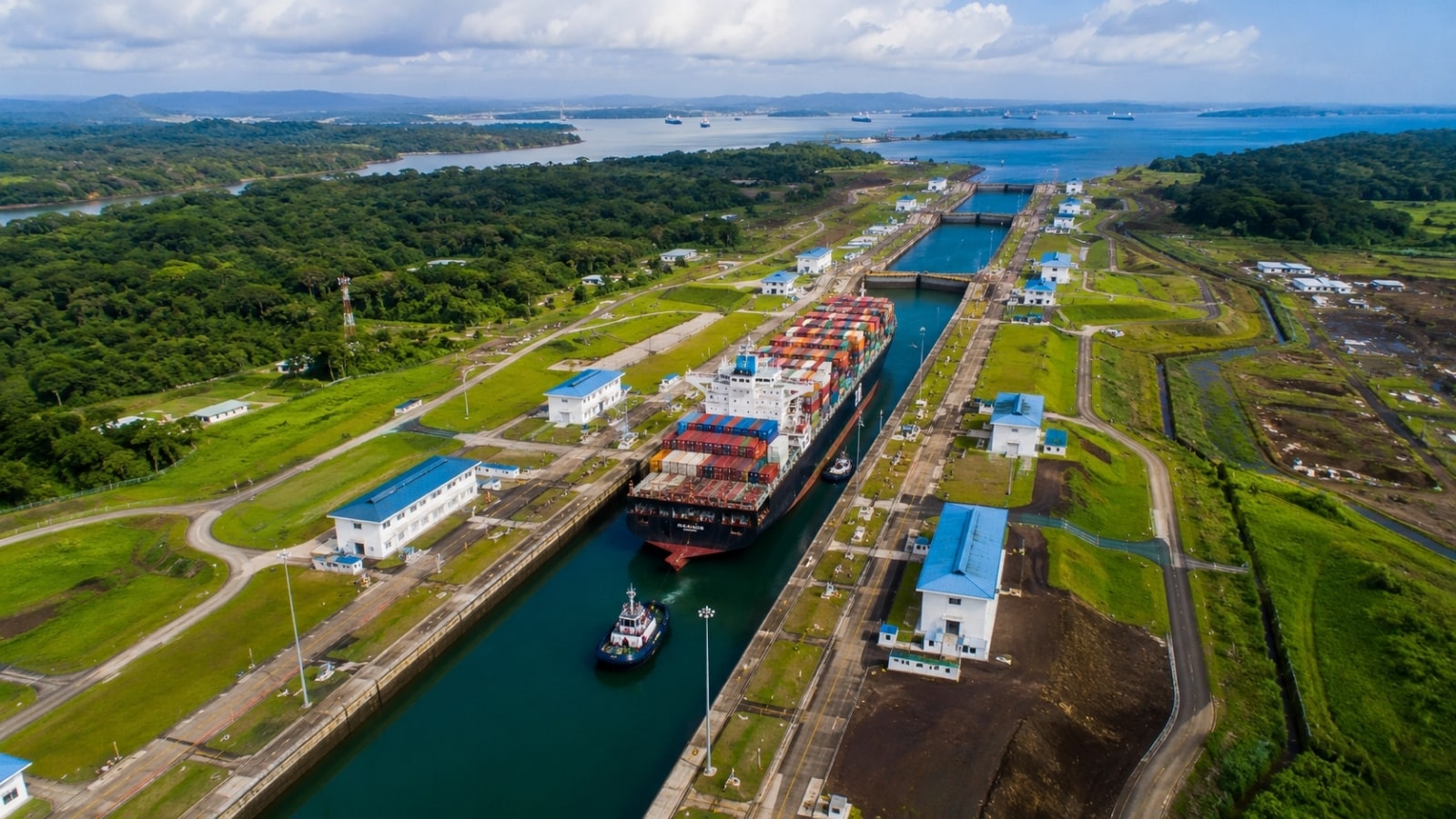
While Suez relies on desert level paths, the Panama Canal is an engineering stairwell. Spanning 82 kilometers across the Isthmus of Panama, it connects the Atlantic and Pacific oceans. Ships enter, step up 26 meters into Gatun Lake using giant freshwater locks, cross the lake, and step back down on the other side.
That shortcut saves vessels a perilous 15,000-kilometer trip around the stormy tip of South America's Cape Horn. In terms of GDP, the canal contributes nearly 3 percent directly to Panama's economy.
Panama's biggest flaw isn't wind—it's fresh water. Every single ship transit flushes roughly 52 million gallons of fresh water from Gatun Lake out into the ocean. When droughts strike Central America, lake levels drop. The canal authority then has no choice but to restrict ship drafts and slash daily transits. In late 2023 and 2024, daily ship passages dropped by over 30 percent. Hundreds of vessels sat anchored on both sides of the canal, waiting weeks or paying millions in private auctions just to skip the line.
The Workhorse Canals You Rarely Hear About
Everyone knows Panama and Suez. But several lesser-known canals process immense volumes of cargo and keep regional economies afloat.
The Kiel Canal
You might assume Suez or Panama holds the title for the highest volume of vessel traffic. It actually belongs to the Kiel Canal in northern Germany.
Running 98 kilometers between Brunsbüttel on the North Sea and Kiel on the Baltic Sea, this canal cuts right through the Schleswig-Holstein region. Sailing through Kiel saves ships about 450 kilometers compared to traveling around the Jutland Peninsula of Denmark. More importantly, it bypasses notoriously violent North Sea storms. Tens of thousands of ships pass through every year, carrying bulk industrial goods, chemicals, and consumer items destined for Baltic ports.
The Houston Ship Channel
Stretching 80 kilometers from the Gulf of Mexico into the heart of Houston, Texas, this canal is the core artery for the American energy sector. It isn't just a transit route—it's a massive industrial corridor lined with refineries, petrochemical plants, and storage facilities.
The Houston Ship Channel enables the United States to export refined petroleum products, liquefied natural gas (LNG), and plastics across the globe. Because it handles deep-draft liquid cargo tankers alongside container shipping, any collision or chemical spill here instantly sends shockwaves through global energy markets.
The St. Lawrence Seaway and Welland Canal
Connecting the Great Lakes to the Atlantic Ocean, the St. Lawrence Seaway system stretches across 600 kilometers of North American waterway. Nestled inside this broader network is the Welland Canal, an essential 43-kilometer bypass that lifts ships past the impassable precipice of Niagara Falls.
This network allows ocean-bound bulk carriers to travel all the way into industrial hubs like Chicago, Detroit, and Toronto. Millions of tons of grain, iron ore, steel, and agricultural equipment move along this route annually. It connects North America's agricultural heartland directly to foreign export markets.
Historic Engineering Marvels and Inland Supply Chains
Beyond maritime trade shortcuts, manmade inland waterways have shaped national boundaries, fed empires, and quietly managed internal supply chains for centuries.
China's Grand Canal
At 1,776 kilometers, the Grand Canal of China is the longest artificial river in the world. Construction started back in the 5th century BC, eventually connecting Beijing in the north to Hangzhou in the south.
While Westerners focus on ocean shipping lanes, China uses inland waterways to balance internal resource distribution. The Grand Canal links major river systems, including the Yellow and Yangtze rivers. Centuries ago, it transported grain to feed northern capitals. Today, active southern sections carry bulk construction material, coal, sand, and industrial equipment, keeping heavy domestic freight off overburdened highways.
The Rhine-Main-Danube Canal
Completed in 1992, this 171-kilometer German canal accomplished a dream centuries in the making: linking the North Sea to the Black Sea. By connecting the Rhine, Main, and Danube rivers, it allows river barges to travel uninterrupted from the Netherlands all the way through Eastern Europe to Romania.
It uses 16 massive locks to scale the Franconian Heights. Barges moving along this route carry bulk raw materials, agricultural products, and heavy machinery across Europe without reliance on cross-border rail congestion.
The Volga-Don Canal
Linking Russia's Volga and Don rivers across a 101-kilometer stretch, this canal connects the Caspian Sea basin directly to the Sea of Azov and the Black Sea. Opening in 1952, it serves as a critical maritime exit route for Russian grain, steel, and oil exports, providing landlocked inland ports with access to international trade routes.
The Corinth Canal
Cut through solid limestone in Greece, the Corinth Canal is one of the most visually striking waterways on Earth. It spans just 6.3 kilometers, cutting through the Isthmus of Corinth to link the Gulf of Corinth with the Saronic Gulf.
It was designed to save smaller vessels a 700-kilometer trip around the Peloponnese peninsula. However, at just 21 meters wide, modern cargo ships are far too wide to use it. Today, it mostly serves feeder ships, cruise liners, and regional tourism, standing as a testament to 19th-century engineering ambition.
How Modern Supply Chains Are Adapting to Canal Disruptions
Dependence on these chokepoints presents real commercial vulnerabilities. When drought, political conflict, or stranded ships slow down canal passages, freight rates spike instantly. Shippers can't afford to sit idle. Companies are re-evaluating their logistics networks and making structural changes.
Diversifying Routes and Modes
Smart supply chain directors aren't putting all their cargo on a single route anymore. They split shipments across multiple channels.
- Cape of Good Hope rerouting: When Red Sea transit risks rise, ocean carriers reroute ships around the southern tip of Africa. It adds 10 to 14 days to Asia-Europe transits, but it guarantees cargo safety and avoids costly canal insurance surcharges.
- Land bridge rail networks: Freight forwarders increasingly use cross-continental rail options, moving containerized cargo from West Coast US ports to Eastern markets via rail to bypass Panama bottlenecks entirely.
- Air freight for high-margin cargo: For electronics, pharmaceuticals, and high-value consumer goods, air transport is roughly three times more expensive than ocean shipping, but it eliminates transit delays when canal bottlenecks worsen.
Nearshoring and Supply Chain Buffering
The trend toward nearshoring—moving manufacturing closer to end consumers—directly reduces reliance on long-distance maritime choke points. Instead of relying solely on just-in-time shipping out of East Asia through Suez or Panama, manufacturers carry higher safety stock in regional warehouses.
What Logistics Leaders Should Do Next
Navigating modern global trade requires proactive risk management around maritime bottlenecks. Here are practical steps to protect your supply chain from the next canal closure:
- Audit your primary shipping lanes: Identify every point where your imported components or finished goods cross a major canal. Determine your exposure to Panama draft limits or Suez congestion.
- Build buffer time into inventory models: Stop planning inventory arrival around best-case transit timelines. Add a 7-to-10 day buffer into lead-time calculations for any freight passing through high-risk canals.
- Secure multi-route contracts with ocean carriers: Negotiate contracts that allow flexible routing options without triggering massive cancellation penalties if cargo needs to be diverted around Africa or shifted to rail.
- Monitor real-time maritime telemetry: Utilize vessel tracking software and real-time draft monitoring to track congestion levels at major lock systems before your containers arrive at the port of origin.